Voxel is a 3D mapping platform that provides a view of both above-ground and underground infrastructure.

Voxel replaces or supplements your existing utility maps and project surveys. Your project engineer and GIS analyst can also combine your data with our global 3D maps, create dashboards for real-time data feeds, simulate and share spatial changes, and create immersive experiences to facilitate planning and design of your projects.

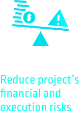
Benefits


Our Insights

Using AI technology to help upgrade electric utility infrastructure
Electric utilities across the U.S. are planning massive investments in the coming years to simultaneously address several related economic, environmental and technological forces. First, utilities need to upgrade aging infrastructure with equipment that is better able to withstand the severe
Continue reading...